A shoreline that rewrites the script
When NASA's Perseverance rover reached the inner edge of Jezero Crater in September 2023, mission geologists had a clear picture of what to expect. The area, known as the Margin Unit, traces the boundary of what was once an ancient Martian lake. Standard geological reasoning pointed to sedimentary deposits — layered accumulations of sand and fine material that would have settled slowly over time. What the rover actually encountered was something else entirely.
Rather than the anticipated sequence of neatly stacked sedimentary layers, the rover's instruments revealed rocks of a considerably more complex origin. The findings, formally presented by NASA in September 2026, indicate that early Jezero was not a quiet, stable lake but a geologically dynamic environment shaped by processes that scientists are still working to untangle.
Turquoise Bay: building a picture, one image at a time
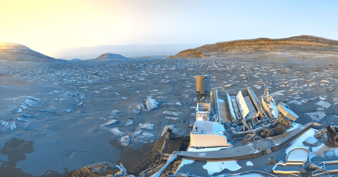
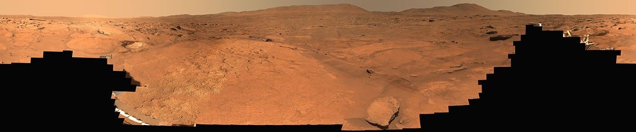
To document this geological puzzle in detail, Perseverance turned its Mastcam-Z camera system toward a specific area of the Margin Unit labeled Turquoise Bay. Between October 5 and October 16, 2023 — sols 933 through 944 of the mission — the rover captured 818 individual frames that were subsequently combined into a full 360-degree natural-color panorama.
The resulting image is more than a visual record. The textures, color variations, and structural features visible across the panorama reveal a mineralogical diversity that tells a story of prolonged rock-water interaction. On Earth, such environments are frequently linked to conditions that can support microbial life — and it is precisely that possibility that drives Perseverance's broader scientific mandate.
Implications for Mars's early history
The unexpected character of the Margin Unit's rocks has consequences that extend well beyond local geology. If the formations lining what should have been a straightforward lakeshore do not match established sedimentary models, the early conditions at Jezero were likely far more variable than previously thought. Possible explanations under consideration include hydrothermal activity, significant fluctuations in water levels, or the influx of material from different geological sources — though no single interpretation has yet been confirmed.
The core samples collected by Perseverance in this area are intended for return to Earth as part of the Mars Sample Return campaign, a joint initiative between NASA and the European Space Agency (ESA). That program's timeline remains subject to ongoing budgetary and engineering reviews. Once those samples reach terrestrial laboratories — equipped with instruments far more sensitive than anything a rover can carry — researchers expect to resolve many of the questions that orbital data and in-situ measurements have so far left open.
For now, every panorama and spectral measurement transmitted from Jezero adds another layer to an increasingly detailed portrait of Mars: not the static, frozen desert of older assumptions, but a world with a long, eventful, and still partially undeciphered relationship with water.