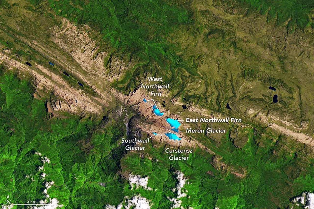
Puncak Jaya: when a glacier stops being a glacier
High above the Indonesian province of Papua, the peaks of Puncak Jaya hold what are almost certainly the last remaining permanent ice bodies anywhere in the tropical belt. For years, researchers have tracked their steady retreat. Now, imagery collected by NASA satellite instruments tells a sharper story: the ice has broken apart into scattered remnants, each patch too thin and too isolated to behave as flowing glacial ice.
That distinction carries real scientific weight. A glacier, by physical definition, requires enough mass to deform under its own weight and move downslope. What the data now shows on Puncak Jaya's flanks — which rise to 4,884 meters above sea level — are static residual patches, frozen in place but no longer meeting the criteria of an active glacier. Pinpointing exactly when this threshold was crossed is difficult, but the transition itself appears irreversible given current climate trajectories.
The drivers are familiar: rising mean temperatures, shifting precipitation patterns, and reduced snowfall at elevation. What satellite observation uniquely provides is a consistent, decades-long record of ice extent, far more comprehensive than what ground-based campaigns could ever produce in such a remote and logistically challenging location. The archive built by NASA's Earth-observing missions turns what might otherwise be anecdotal fieldwork into quantifiable long-term trends.
Mangroves: a measured recovery, confirmed from space
Set against that bleak picture, a separate finding from NASA's Earth science programs offers a more encouraging signal. Mangrove forests — the dense, salt-tolerant woodlands that line tropical and subtropical coastlines — appear to be staging a genuine, measurable recovery after decades of retreat.
Between the 1980s and the early 2000s, these intertidal ecosystems lost significant coverage worldwide, cleared for shrimp farming, coastal development, and agricultural conversion. Multi-temporal satellite analysis now indicates that the global trend has reversed: total mangrove extent is growing at the planetary scale, according to data processed by NASA research teams.
The recovery is not uniform across regions. Parts of Southeast Asia and Central America continue to record localized losses. But globally, gains driven by active restoration programs and natural recolonization of previously degraded shorelines now outpace destruction. The ecological stakes are high: mangroves sequester carbon at rates that rival terrestrial forests, buffer coastlines against storm surge and erosion, and support the nursery habitats on which much of the world's coastal fisheries depend.
What continuous observation from orbit actually means
Taken together, these two datasets illustrate something fundamental about how Earth science now functions. Without the unbroken satellite records accumulated over decades — by NASA, the European Space Agency, and an expanding network of operators — it would be nearly impossible to separate genuine long-term trends from year-to-year variability.
Ice retreating on a Papuan summit and mangroves reclaiming tropical shorelines: neither phenomenon is fully legible at the local scale alone. Only a view from orbit gives researchers the spatial breadth to understand what is actually happening across entire mountain ranges, entire coastlines, entire ocean basins. The harder question — whether that understanding translates into policy action proportionate to what the data reveals — remains, for now, unanswered.