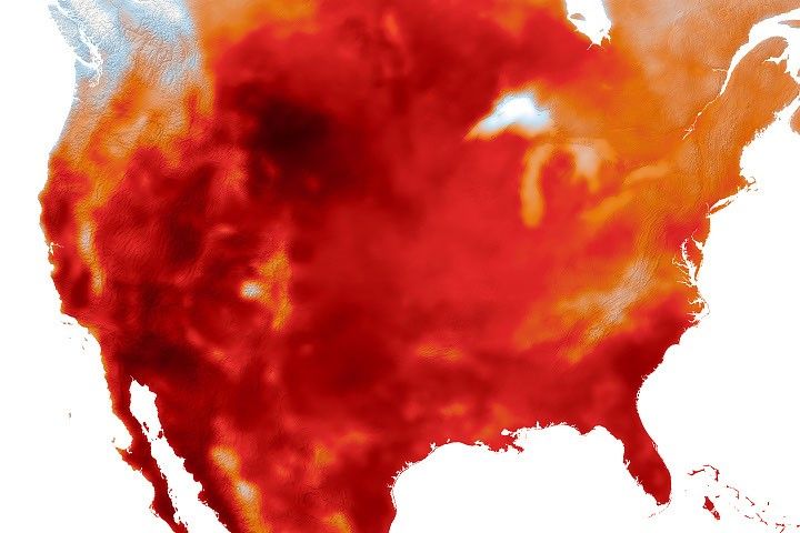
A Continent Running Hot
By midsummer 2026, Europe had endured multiple consecutive heatwave episodes that pushed temperature records to new extremes across several countries. NASA's Earth science division, drawing on data from its fleet of Earth-observing satellites, has been tracking these thermal anomalies with precision — documenting not just peak temperatures, but the duration, geographic spread, and intensity of heat retained in urban zones and parched agricultural land. What the data shows aligns with what ground-based meteorological networks have been recording: this is not an isolated spike, but a pattern that is becoming structurally embedded in European summers.
Space-based observation tools have proven essential in this context. Infrared sensors aboard satellites operated by NASA and partner agencies can distinguish between surface temperatures with a resolution and consistency that no ground network can match at continental scale. These instruments track the movement of heat domes, measure soil moisture depletion, and monitor the urban heat island effect in real time. The role of orbital science in climate monitoring — often underplayed in public discourse — has rarely been more starkly demonstrated.
Kourou Mapped, Ariane Transitioning
Against this backdrop, ESA released an updated cartographic overview of the Guiana Space Centre, Europe's primary launch facility located near Kourou in French Guiana. While the site sits in an equatorial climate zone and is not affected by the same heatwaves battering continental Europe, the timing of the publication draws attention to a broader question: how climate conditions — wherever they occur — shape the operational realities of space infrastructure.
The Guiana Space Centre is currently navigating a significant transitional phase. Ariane 5 has been retired, and Ariane 6 — whose first commercial mission took place in 2024 — is still ramping up to full operational tempo. Vega-C flights have also resumed following a mission failure in late 2022 that led to a lengthy stand-down. The detailed map released by ESA offers a clearer picture of the site's complexity: launch pads, vehicle assembly buildings, hazard perimeters, and the dense web of support facilities operated by Arianespace and its contractors. This infrastructure, built over decades, must now also be assessed for resilience against increasingly volatile tropical weather patterns.
From Orbit to Policy: Closing the Loop
The connection between Europe's scorching summer and the work of space agencies runs deeper than optics. ESA's Copernicus Earth observation programme, alongside NASA's Landsat archive and GOES geostationary platforms operated with NOAA, forms the backbone of global climate monitoring. Every heatwave that sweeps across Europe is captured, measured, and fed into climate models that inform adaptation planning at national and regional levels.
But a more uncomfortable question is beginning to surface within the space sector itself: as agencies document the accelerating consequences of climate change from orbit, are they adequately preparing their own ground infrastructure for those same consequences? Launch centres, mission control facilities, and manufacturing sites all face growing exposure to extreme weather events — whether that means heatwaves in Europe, intensified tropical storms near equatorial launch sites, or shifting sea levels along coastal facilities. The answer to that question, for ESA, NASA, and the broader industry, remains a work in progress.